- Inspire
- Innovate
- Integrate
Transforming Engineering, Construction & Planning with Precision Scanning
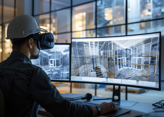
At Conserve Solutions, we provide high-accuracy 3D laser scanning services that enhance project planning, engineering, and construction workflows. Our cutting-edge technology enables detailed, data-rich visualization and business intelligence, allowing you to capture existing conditions with unmatched precision.
Whether for as-built documentation, Scan-to-BIM integration, clash detection, or retrofit planning, our 3D laser scanning solutions streamline project execution while reducing costs and minimizing rework.
Key Benefits of 3D Laser Scanning
Our drafting services help you
Faster Data Collection
Up to 10x quicker than conventional methods.
Higher Accuracy
Reduce errors, rework, and clashes with millimeter precision.
Cost Savings
Optimize material usage and eliminate on-site re-surveys.
Seamless Integration
Compatible with BIM, CAD, GIS, and engineering platforms.
Reduced Downtime
Non-intrusive scanning with minimal disruption to operations.
Our 3D Laser Scanning Solutions
On-Site 3D Laser Scanning
High-definition 360° panoramic scans for detailed site documentation.
Fast and accurate data collection for real-time engineering analysis.
Minimal disruption to ongoing operations.
Scan-to-BIM Conversion
Point cloud to BIM conversion for accurate 3D models.
Seamless integration with Revit, AutoCAD, Navisworks, and GIS platforms.
Enhanced visualization for design validation and clash detection.
Digital Survey & Dimensional Control
High-precision total station surveys to validate scanner positions.
Accuracy of 2mm to 5mm for precise as-built documentation.
Improved topographic and structural integrity analysis.
As-Built Documentation & Analysis
Comprehensive as-built drawings and models for renovations and retrofits.
Data-driven insights for facility management and structural assessments.
Eliminate manual errors and reduce construction delays.
Smart Laser Measurement Solutions
Quick facade, height, area, and distance measurements.
Mobile-enabled measurements via iOS and Android devices.
Integration with GIS, CAD, and AEC software for enhanced project workflows.
Industries & Applications
Additionally, we provide animated walk-throughs generated from point cloud models for better visualization and decision-making.
Why Choose
Conserve Solutions?
State-of-the-Art Technology
Industry-leading laser scanning equipment.
Experienced Professionals
Skilled technicians for onsite & remote scanning.
Tailored Deliverables
Output in 2D, 3D CAD, or various scan formats.
Multi-Software Compatibility
Integration with AutoCAD, Revit, Navisworks, ArcGIS, and more.
End-to-End Solutions
From data collection to BIM modeling.
Get Started with 3D Laser Scanning Today!
Contact Conserve Solutions to transform your projects with precise, efficient, and cost-effective 3D laser scanning services. Let’s capture your project’s reality with accuracy and intelligence.
Subscribe
Get latest news & events details
Quick Links
+1 (832) 475-9130
+44 0786 7249154
+91 73059 60692
+91 96772 63895
+65 8709 8733
+966 55 720 9522
+974 44427968
+971 45657706
Copyrights © 2025. Conserve Solutions. All Rights Reserved.